The Center is actively engaged in the development of such a line of activities as “information technologies in the field of environmental protection”, which includes the development of geographic information system, corporate environmental systems of enterprises, automated systems for environmental monitoring and analysis, applied environmental calculations, etc.

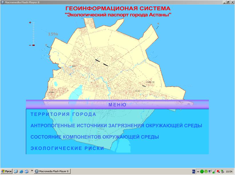
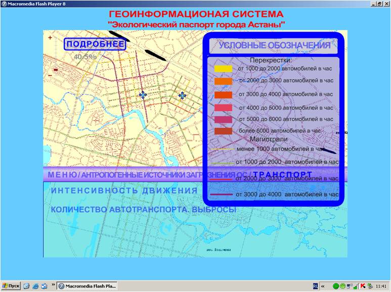
Geographic information systems “Ecological passport of the city” is created within the framework of the relevant research works devoted to the study of the ecological state of urbanized areas, including an assessment of the quality of the main components of the environment and public health. Geographic information systems named “Ecological passport of the city” contain the results of scientific research and allow you to collect information, create databases, store, process, transform and provide information on the level of environmental pollution at the user’s request in cartographic form, in the form of tables, graphs and texts.
Main tasks of Geographic information systems named “Ecological passport of the city” are:
- centralized consolidation of information that comprehensively characterizes the state of the urban environment;
• maximum information support for environmental services in the region for the operational execution of the functions of environmental control and management decisions;
• provision of public authorities, scientific, project and public organizations, the population with the necessary reliable information on the state of the components of the urban environment and public health;
• development and improvement of the system for the exchange of scientific and technical information in the field of environmental safety of urban areas.
As part of scientific works, the Center developed a number of ECO passports for the regions of the Republic of Kazakhstan:
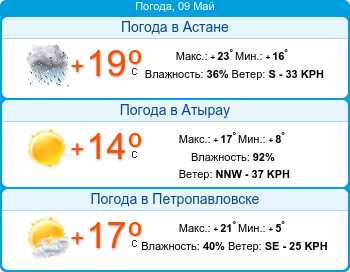
• GIS “Ecological passport of Astana city”
● GIS “Ecological passport of Atyrau city”
● GIS “Ecological condition of the basin of the Ural River”
● GIS “Ecological passport of Aktau city”
● GIS “Ecological passport of Pavlodar, Ekibastuz and Aksu cities”.
● GIS “Mercury-containing wastes of the Aktobe region”.
● GIS “Ecological passport of Zhana Ozen city”
● GIS “Ecological passport of Aktobe city”
● GIS “Ecological passport of the Munayly region”
● GIS “Ecological passport of the Mangistau region”
● GIS “Anthropogenic impact on the Ishim river basin within the North-Kazakhstan region”.
Research work was carried out at the request of such state agencies as:
• Ministry of Environmental Protection of the Republic of Kazakhstan (Ministry of Energy of the Republic of Kazakhstan);
• Ministry of Agriculture of the Republic of Kazakhstan;
• Ministry of Education and Science of the Republic of Kazakhstan;
• Natural Resource Management and Environmental Management of Astana;
• Management of natural resources and environmental management of the Aktyubinsk region;
• Natural Resource Management and Environmental Management of Atyrau region;
• Management of natural resources and environmental management of the East Kazakhstan region;
• Natural Resource Management and Environmental Management of Zhambyl region;
• Management of natural resources and environmental management of the Karaganda region;
• Management of natural resources and environmental management of Mangistau region;
• Management of natural resources and environmental management of the North-Kazakhstan region;
• Environmental Protection Department of Pavlodar region;
• Department of housing and communal services, passenger transport and highways of Aktobe city.